LOCATION
The Henry Bowers House is located at 1789 Poor House Road, in Berkeley County, West Virginia. Poor House Road is named after the historic County Poor Farm, located 2 miles north of this property, which now serves as a county park. The park contains an equestrian arena, soccer and football fields, hiking paths, a lake and stream for fishing as well as a restored stone barn available for events.
This 46 acre property is situated in a beautiful and historic location, with 1/2 mile of paved frontage and side road. It is located at the headwaters of Tuscarora Creek, at the foot of North Mountain and overlooks Apple Pie Ridge to the east. Berkeley County is the fastest growing county in the state and serves as a bedroom community to the Washington DC metro area. The property is approximately 3 miles west of Interstate 81, 4 miles from a major shopping center, and 6 miles to the MARC Commuter train to Washington DC. It is a convenient location 8 miles from Virginia, 10 miles from Maryland, 20 miles from Pennsylvania, 45 miles northwest of Dulles International Airport and 65 miles from downtown Washington DC.
Both Martinsburg and Berkeley County were heavily involved in the Civil War with the city changing hands between the Union and Confederate Armies 37 times. There are accounts of Confederate troops camping on the Bowers' property, and JEB Stewart, famous southern cavalry general, passing though the area on his way to Chambersburg and Gettysburg. Civil War battlefields are all nearby; Antietam 25 miles, Winchester 22 miles, Cedar Creek 41 miles, Harpers Ferry 30 miles, and Gettysburg 65 miles.
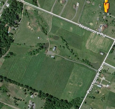
Aerial view of the subject property. Note frontage on Poor House and Needmore Roads.
|
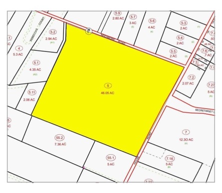
Tax Map of subject property.
|
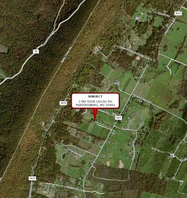
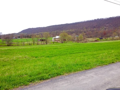
Subject property and neighboring community. North Mountain on the
left and Apple Pie Ridge on lower right.
Land Description: Approximately 34 acres are tillable farmland and the current crop is hay. The remainder of the land is pasture including springs, three spring fed ponds, some natural wetlands and the headwaters of the Tuscarora Creek. The rolling landscape has a gradual increase in elevation of approximately 100 feet from the front to the rear of the property.
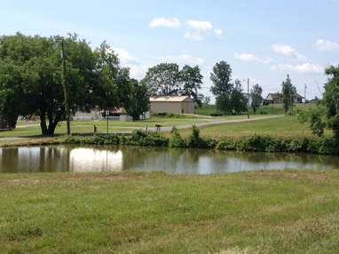
Front Pond by Poor House Road.
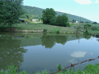
Back Pond looking toward North Mountain.
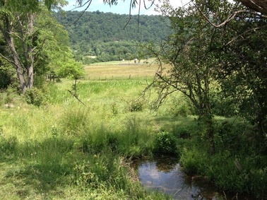
Wetlands near the creek
|
USES
The house and surrounding property is being used by the current owners as their home and a working farm. Approximately 34 acres of the land is productive fertile farmland and 12 acres is in pasture, bordering each side of the creek. The crops currently being raised are alfalfa and orchard grass hay, with beef cattle currently being raised in the pasture. The four year round spring feed ponds have been stocked with native fish. Besides being a wonderful place to raise a family its excellent soil would make a great organic farm, equestrian center, commercial or residential real estate development, or a special events center. 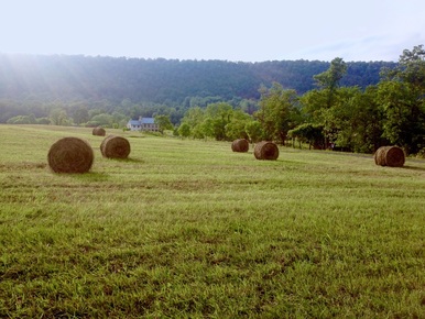
Harvesting hay, taken from Poor House Road looking West. Note the
house in the background.
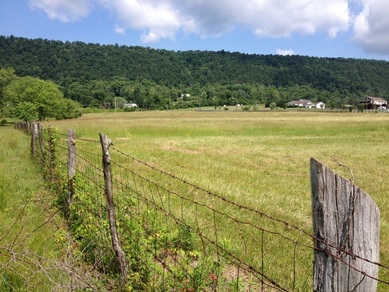
Hayfield on the North side of the property. Pasture to the left of the fence.
Taken from Needmore Road looking SSW.
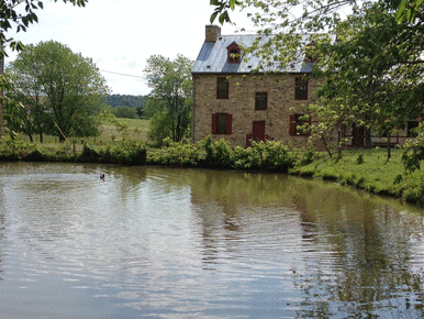
Pond in back of the house.
|